Hey everyone,
I’m pleased to share with you the progress we’ve made. We’re at a place I never could have imagined when we started the project back in August of last year.
Since the start of 2023, I’ve been focusing on web design and mapping. Gian over in Argentina has been working on the new explore grid and route pages.
Let me show you what we’ve accomplished.
Launch Date
We are hoping ‘soon’… Don’t you just hate it when people say that? Let’s be real… We are just months away! Aiming for Q2 2023.
Estimated launch was this month. However, we’ve taken on new features that we never envisioned a few months back.
The launch will be on Kickstarter. We’ll put the word out when we’re close.
California is nearly finished!
It’s been a journey for sure, and it’s almost finished! Here’s a behind-the-scenes look at California. I flipped Cali on its side so you can see the big picture.
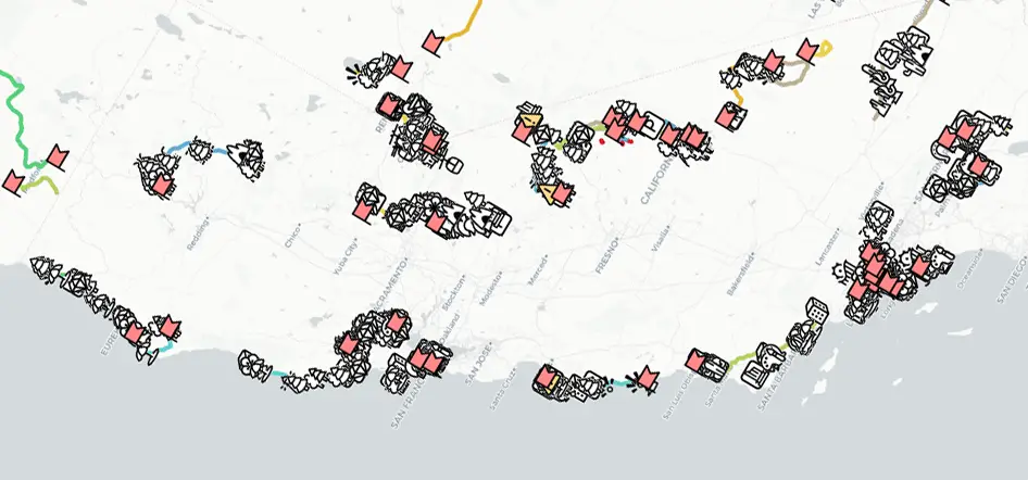
What you’re seeing is the development view I have whilst plotting out the hundreds of must-see destinations, hikes and hidden gems.
I’d say there’s around 700 POI’s you’re seeing in that screenshot. Each one is hand plotted with information and images.
All hikes are hand drawn to ensure you only go on those worth talking about.
In the future (with enough support and funding) we’ll be able to employ others to help with this vital but time-consuming task.
Explore the Grid
I’m a huge fan of maps, but people can struggle with them. I get it. So we have come up with the ‘Explore Grid’. A way to view and filter all available scenic drives depending on your mood and location.
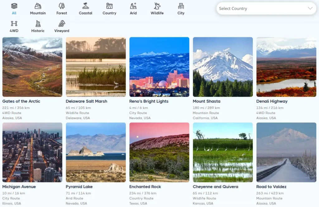
Simple with no baggage. You’re in the mood to see wildlife routes in Canada – no sweat. It’s all possible with the grid.
One thing that’s on our minds is to filter also by state. It does get tricky, especially with different countries, but we’re going to explore it.
Route Pages
So you’ve found the perfect drive on the explore grid… select it, and it will take you to that routes ‘page’.
The goal is to provide all the route information you need in one convenient place.
Mount Shasta looks like a stunning destination…
Let’s have a look.
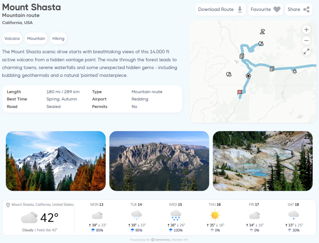
As you can see, key information is provided and even the weather! The ability to download routes as a GPX file and save your favorite routes will be available to members.
Below what you see in the screenshot, there will be a lot more information about the route. Everything from the best towns to stay in, to required permits etc.
We’re still piecing this section together, and it will be made available to members only.
Well, that’s it for now. If you like what you see, we need your support to make this all possible. Stay tuned for our funding launch, share with your friends and follow us on twitter.
Talk soon
Leave a Reply